
Watershed Articles Series
Management and Policies in Tulare Basin
One Watershed Series
Welcome! The Tulare Basin Wildlife Partners has written eight One Watershed articles. These articles aim to raise awareness about the Tulare Lake Basin watershed, its issues, its challenges, its opportunities, and management strategies.
Climate Impacts on Drought and Fire: Watershed Solutions Needed
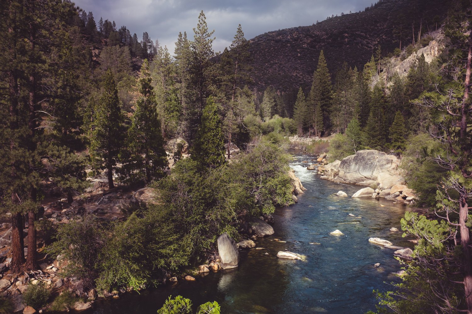
Watershed Connections: Forest Health and Its Impacts Downstream
Anticipating El Niño: History informs wet winter challenges and opportunities
Water, Environmental Justice, and the Underserved of the Tulare Basin
Tulare Basin Regional Conservation Reports
To address current and potential land and water management challenges, the Tulare Basin Working Group, an alliance of over 70 non-profit, agency, and industry partners, directed Tulare Basin Wildlife Partners (TBWP) to develop a comprehensive conservation plan for the Tulare Basin, built on, updating, and expanding existing conservation plans. In 2010, TBWP completed the Tulare Basin Regional Conservation Report, which identifies important lands to protect or restore: seasonal and permanent wetlands, riparian areas, and upland habitat, benefiting wildlife and people in the Tulare Basin. The conservation lands would be managed by federal agencies, states, tribes, cities, non-profit organizations, and private landowners. The majority of the lands would remain as privately-owned, working landscapes.
Click here to learn more about how Conservation Reports are structured and released.
Conservation Reports
Buena Vista/Kern Lake Conservation Report
Fresno County Measure C Riparian-Wildlife Corridor Report
Goose Lake Conservation Report
Sand Ridge/Tulare Lake Conservation Report
Tulare Basin Conservation Plan Water Supply Strategies Report
Tulare Basin Riparian & Wildlife Corridor Conservation Report
Tulare County Measure R Riparian-Wildlife Corridor Report
Tulare Basin Watershed Connections Collaborative
The Tulare Basin Watershed Connections Collaborative (TBWCC) is a collaborative of natural resource managers working together to advance watershed planning and resource management in the Tulare Basin based on sound science and mutually identified needs for regional economic and ecological sustainability. The group conducts its work through active subcommittees and convenes as a full group on a quarterly basis to coordinate overarching strategies. The TBWP founded the Watershed Connections Workgroup (rechristened the Watershed Connections Collaborative) as an evolution of the Tulare Basin Working Group, which the TBWP coordinated for 11 years. Michelle Selmon, DWR Climate Change Specialist, served as the group's coordinator until January 2018. The TBWCC is now coordinated by the Tulare Basin Watershed Partnership.
The group's goal is:
To advance collaborative watershed planning and resource management in the Tulare Basin based on sound science and mutually identified needs for regional economic and ecological sustainability.
Integrated Regional Water Management | IRWM Plans
What is an IRWM?
Integrated Regional Water Management (IRWM) is a collaborative effort to manage all aspects of water resources in a region. IRWM crosses jurisdictional, watershed, and political boundaries; involves multiple agencies, stakeholders, individuals, and groups; and attempts to address the issues and differing perspectives of all the entities involved through mutually beneficial solutions. IRWMs are established by the California Department of Water Resources.
The IRWM process looks at water management issues from a multitude of perspectives as diverse stakeholders engage one another. That process can yield multi-benefit projects that meet several entities’ goals and objectives in a more cost effective manner than each entity acting on its own. Previously, water management entities tended to work with a narrow focus on their service area and primary function, sometimes competing against similar efforts to resolve similar issues or advancing duplicative efforts.
There are seven IRWMs in the Tulare Basin Hydrologic region, which are, from north to south (approximately):
Click here to learn more about each IRWM.
Sustainable Groundwater Management in the Tulare Basin
What is SGMA?
From water.ca.gov:
In September 2014, Governor Edmund G. Brown Jr. signed a three-bill package known as the Sustainable Groundwater Management Act (SGMA). The legislation allows local agencies to customize groundwater sustainability plans to their regional economic and environmental needs. SGMA creates a framework for sustainable, local groundwater management for the first time in California history.
“A central feature of these bills is the recognition that groundwater management in California is best accomplished locally. Local agencies will now have the power to assess the conditions of their local groundwater basins and take the necessary steps to bring those basins in a state of chronic long-term overdraft into balance.” –Governor Edmund G. Brown Jr.
The Sustainable Groundwater Management Act:
Provides for sustainable management of groundwater basins
Enhances local management of groundwater consistent with rights to use or store groundwater
Establishes minimum standards for effective, continuous management of groundwater
Provides local groundwater agencies with the authority, technical, and financial assistance needed to maintain groundwater supplies
Avoids or minimizes impacts for land subsidence
Improves data collection and understanding of groundwater resources and management
Increases groundwater storage and removes impediments to recharge
Empowers local agencies to manage groundwater basins, while minimizing state intervention
SGMA requires local agencies to establish a new governance structure, known as Groundwater Sustainability Agencies (GSAs), prior to developing groundwater sustainability plans for groundwater basins or sub-basins that are designated as medium or high priority.
Sustainable Groundwater Management Act Resources for the Tulare Basin
Glossary of Terms
Click here to see the entire glossary of terms.
Click these links to learn more about native, special status plants:
Bureau of Land Management
Special Status Plant Program
Calflora
Searchable database of all 8375 currently recognized vascular plants in California, including 20000 photographs.
California Native Plant Society
Rare Plant Program
California Natural Diversity Database
Inventories of the status and locations of rare plants and animals in California.
California State University, Stanislaus
Endangered Species Recovery Program
U.S. Fish & Wildlife Service
Endangered & Threatened Plants
About the Tulare Basin
Habitats: Vernal Pools
Click here to learn more about vernal pools.
Maps
Tribal Map of Tulare Basin (1)
Tribal Map of Tulare Basin (2)
Tulare Basin Natural Communities & Developed Land, 1912
Source: Scott Philips, Endangered Species Recovery Program
Tulare Basin Natural Communities & Developed Land, 2000
Source: Scott Philips, Endangered Species Recovery Program
Tulare Basin Disadvantaged Communities Map with Conservation Corridors
Source: California Water Institute and CSU Fresno.
Integrated Regional Water Management (IRWM) groups in the Tulare Basin
Source: Kings River Conservation District
San Joaquin Valley Greenprint Website
The San Joaquin Valley Greenprint is a voluntary, stakeholder-driven project that provides agricultural, water, and environmental leaders with improved planning data and fosters regional collaboration on strategies that prioritize resource sustainability while enhancing economic prosperity. It focuses on the challenges and opportunities in non-urban land use planning, and how those rural decisions shape the region’s economy and environment.
The SJV Greenprint provides the following:
Map Database
Regional Planning Forums
Conservation Vision
Prior event resources
Click here to learn more about prior events.
Archive
CVJV 2020 Implementation Plan
Excerpt from Executive Summary:
The Central Valley Joint Venture 2020 Implementation Plan uses the best available science to establish habitat and population objectives for the major groups of birds in the Central Valley of California. The Plan is intended to be useful to policy makers, regulators, agencies, conservation organizations and landowners working to further bird habitat conservation efforts in the Central Valley. The Plan represents the combined expertise of a wide range of professionals from conservation organizations, state and federal agencies and the private sector.
Conceptual Project List
Click here to read the TBWP/TBWI Conceptual Project List.
Click here to read the TBWP/TBWI Climate Adaptation Project List.
Click here to read the Tulare Basin Wetland and Riparian Water Supply Needs.
Climate Change Adaptation Solutions
TBWP seeks to integrate multiple "ecosystem services" benefits into water and other natural resource projects. Ecosystem services are resources and processes supplied by natural ecosystems that benefit humans, and include the following:
Purification of air and water
Mitigation of floods and droughts
Detoxification and decomposition of wastes
Soil and soil fertility generation and renewal
Pollination of crops and natural vegetation
Control of agricultural pests
Dispersal of seeds and cycling of nutrients
Restoration of wetlands and uplands to diversify species
Recreation and education opportunities
Protection from ultraviolet rays
Climate change adaptation strategies
Learn more about these climate change adaptation solutions here.
Habitats: Herbaceous Plants | Shrubs | Trees
Herbaceous Plants
Herbaceous plants, such as grasses and wildflowers, do not produce woody tissue, are green and leaf-like in appearance or texture, and generally die back at the end of each growing season. Fourteen of the 39 habitats found in the Tulare Basin are dominated by herbaceous plants; 10 feature wetlands, three are found in upland areas, and one is found in either upland or wetland conditions. Grasses dominate seven habitats; six feature wetland reeds, tules, and sedges; and one habitat hosts floating plants.
Click here to read the full list of Habitats and their Dominant Herbaceous Plants in the Tulare Region.
Shrubs
Shrubs, or short woody plants with two or more stems growing from the base, dominate 13 of the 39 habitats. Four are upland habitats, one is a transitional habitat found both in wetland and upland areas, and eight feature wetlands.
Click here to read the full list of Habitats and their Dominant Shrubs in the Tulare Region.
Trees
Trees, or tall woody plants growing from one stem or trunk, dominate 10 of the 39 habitats. Seven of the tree habitats feature wetlands and three are found in upland conditions. One habitat, the eucalyptus naturalized forest, is a non-native habitat. The descriptions below follow A Manual of California Vegetation, by J.O. Sawyer and T. Keeler-Wolf, 1995, which defines habitats based on the plant associations found in a series or particular plant community.
Click here to read the full list of Habitats and their Dominant Trees in the Tulare Region.
Species: Wildlife | Plants
Wildlife of the Tulare Basin
The Tulare Basin hosts an amazing concentration of endangered, threatened, or sensitive animal species, including nine invertebrates, three amphibians, five reptiles, 42 birds, and 13 mammals. Some animals are only found in the Tulare Basin, others are endemic to California and a few range throughout western North America.
Over the past century, modifications to the Tulare Basin's land and water have resulted in the critical status given to these animals. Loss, fragmentation, and degradation of wetlands and uplands have reduced the availability of food and other resources, while restricting and isolating populations. A variety of factors contributed to habitat loss and continues to threaten these species:
Changes in agricultural practices or poorly-managed grazing
Changes in water flow and management
Invasion of non-native plants
Mining and petroleum extraction
Off-highway vehicle use
Parasites and disease
Pesticide, insecticide or rodenticide spraying and drift
Predation from introduced species
Shooting, trapping and poisoning
Urbanization and industrial developments
Water pollution and degraded water quality
Climate change
The Tulare Basin Wildlife Partners works to protect our unique and exciting animal diversity, resulting in a watershed that is more vibrant, resilient, and healthy for people and nature alike.
Click here to read the full list of Tulare Basin's sensitive animal species.
Unique Plant Species of the Tulare Basin
The Tulare Basin offers a safe harbor for 53 threatened, endangered, or sensitive plant species, the majority of which are endemic to California. Over the past century, these plants have declined significantly due to habitat loss, fragmentation, and degradation resulting from human modifications to the landscape for urban, agricultural, mineral, and other needs.
Today these sensitive plants grow in a limited range or are rare throughout their range. Remaining populations face a high risk of extinction from additional threats, such as:
Lack of genetic diversity and small population size
Vulnerability to diseases and parasites
Environmental fluctuations, catastrophes, and genetic drift
Competition from introduced, non-native annual grasses
Air pollution
Pesticide effects on pollinators
Climate change
Changes in water flow and timing; flooding
The Tulare Basin Wildlife Partners (TBWP) is working to protect and restore our native plant communities to keep our watershed healthy now and for future generations.
Click here to read the full list of Tulare Basin's sensitive plant species.